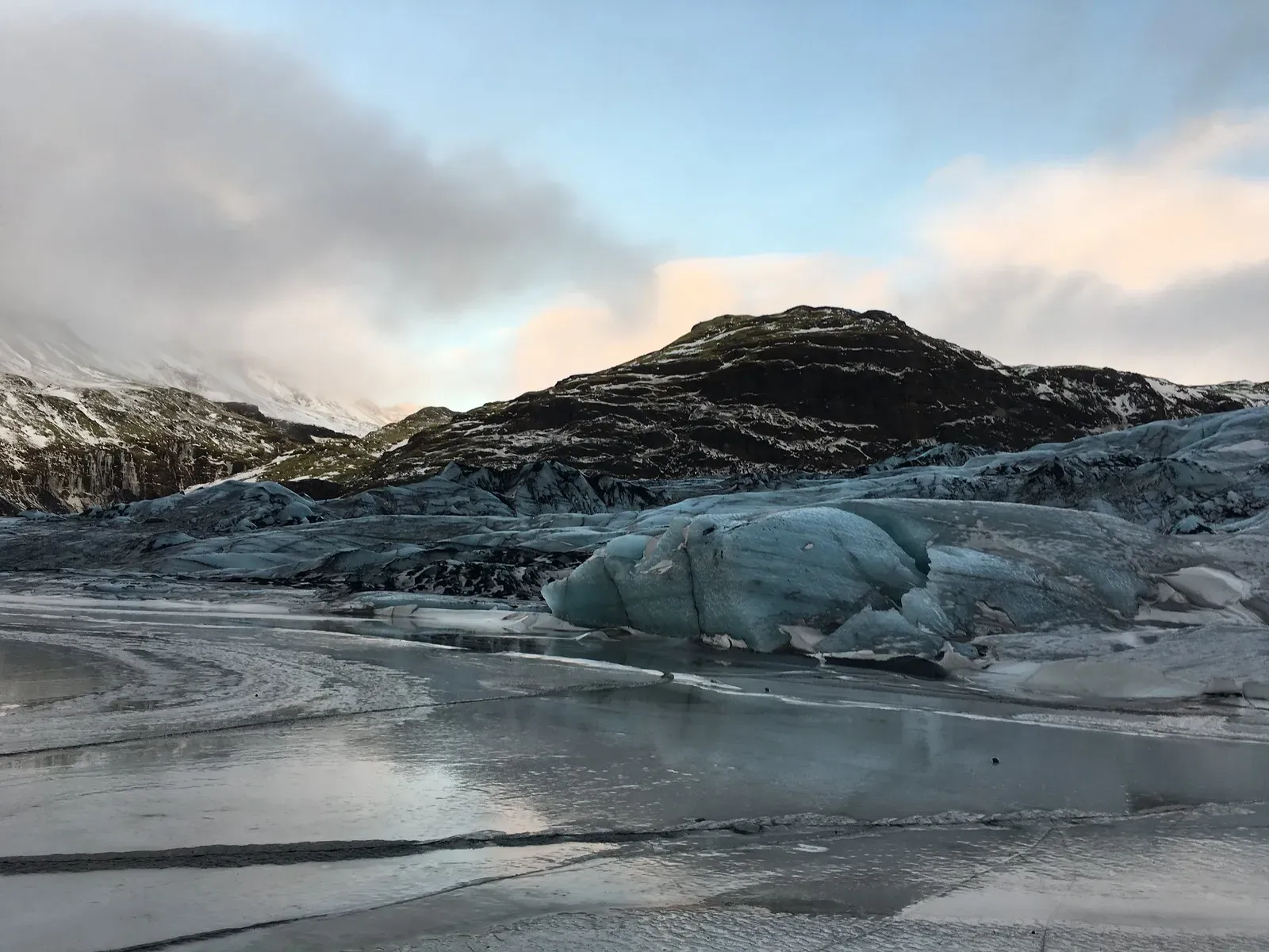
Sólheimajökull is an 8-kilometer-long ice tongue extending from the Mýrdalsjökull ice cap in southern Iceland. A short paved road brings visitors almost directly to the ice, making it one of the most accessible glaciers in the world for climate research and hiking.
Sólheimajökull is an 8-kilometer-long outlet glacier that spills off the southwestern edge of the Mýrdalsjökull ice cap in southern Iceland. It sits directly between the Katla and Eyjafjallajökull volcanoes. The ice tongue measures just over 2 kilometers wide and terminates in a murky proglacial lagoon. Meltwater from this snout feeds the Jökulsá á Sólheimasandi river. This river cuts a path across a vast black-sand outwash plain before emptying into the Atlantic Ocean.
Visitors reach the site via Road 221, a short paved side route off the Ring Road. The drive from Reykjavík covers 158 kilometers and takes about two hours. Travelers coming from Vík í Mýrdal drive 32 kilometers west, a trip of about 25 minutes. Public transit does not service the glacier directly. Travelers without a car must take a Strætó bus to Vík and arrange a taxi for the final stretch, or book a guided day tour from the capital.
A 500-meter gravel trail leads from the parking lot to the glacier viewpoint. The walk takes 15 minutes. The path winds through a quiet volcanic valley where bright green moss covers jagged black basalt. At the end of the trail, the glacier's blue-and-black ice snout rises above the lagoon. Small icebergs drift in the water below. Families with young children can easily manage this flat walk. The actual ice hikes require a minimum age of eight and a shoe size of at least EU 34 to fit the mandatory crampons.
This accessibility makes Sólheimajökull a primary hub for guided ice climbing and glacier hikes. Outfitters run daily tours where visitors strap on crampons and carry ice axes to walk among the crevasses. Kayakers paddle directly through the meltwater lagoon to view the ice from water level. The glacier is shrinking rapidly. It loses about 60 meters of ice each year to rising global temperatures. Glaciologists track this retreat closely. Tour guides point out markers showing where the ice stood just a few years ago. The landscape changes constantly. Check the Icelandic Meteorological Office alerts before visiting, as rapid melting occasionally destabilizes the ice margins and forces temporary closures.
May through September offers the best weather and easiest trail conditions. Winter brings icy access trails and short daylight hours. Storms between December and February frequently close Road 221. High winds and freeze-thaw cycles also increase the rockfall risk along the access route. Plan your visit accordingly.
Glaciologists have monitored Sólheimajökull for over a hundred years. Early 20th-century records show the glacier's leading edge extending well past today's parking lot. The ice advanced and retreated in natural cycles until the late 20th century. Formal, continuous tracking by the Glacier Research Society of Iceland began in 1995. Between 1995 and 2014, researchers recorded 887 meters of linear retreat. The melt rate now averages 60 meters per year. This rapid, sustained loss of mass has fundamentally altered the valley's geography.
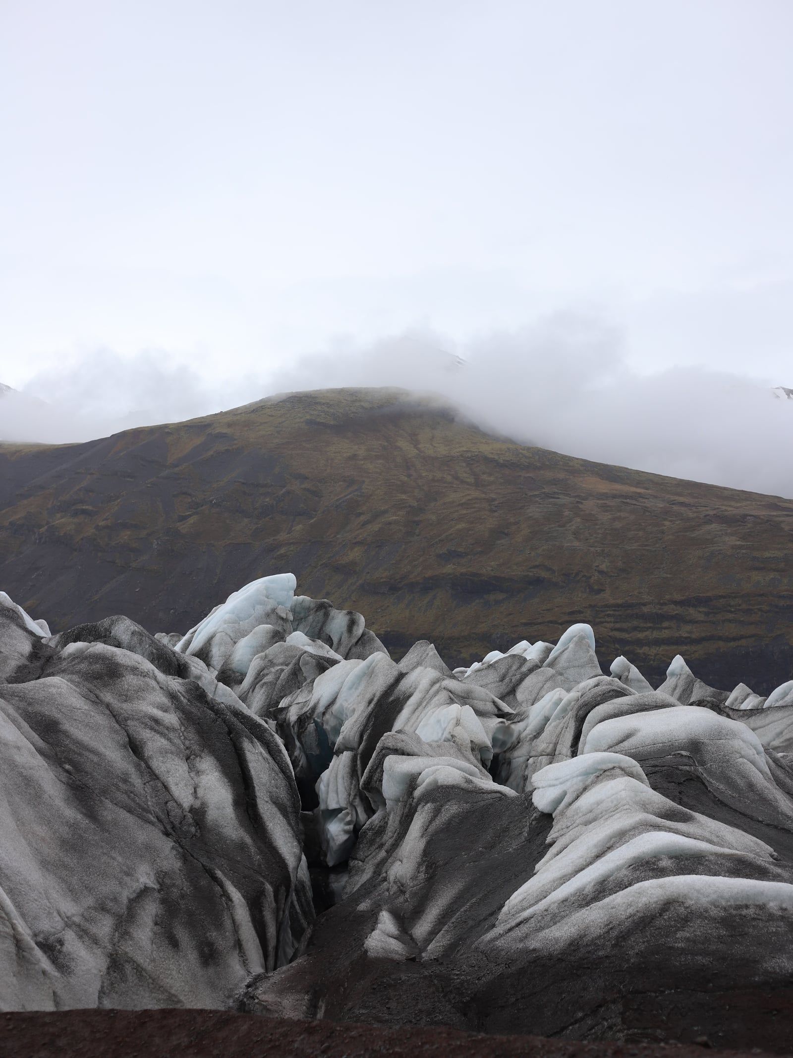
Sólheimajökull sits atop the Katla volcanic caldera and adjacent to Eyjafjallajökull. Eruptions from these volcanoes deposit thick layers of ash onto the parent Mýrdalsjökull ice cap. As the glacier flows downhill, these ash layers compress into dark bands. The 2010 Eyjafjallajökull eruption coated the glacier in a fresh layer of tephra. This recent ash is still visible on the surface today. It mixes with older black streaks to give the ice a distinct striped appearance. The dark dirt absorbs solar radiation. This accelerates the melting of the surrounding ice.
The rapid pace of melting continuously alters the landscape. The proglacial lagoon at the glacier's base expanded significantly over the last two decades. New, smaller lagoons frequently form along the eastern margin. In July 2026, the Icelandic Meteorological Office issued a formal hazard notice. Rapid melting had destabilized an ice ridge near the lagoons. It also increased the rockfall risk from the adjacent Jökulháls mountain. Several tour operators suspended their hikes immediately. Guides had to scout entirely new, safer routes onto the ice before resuming operations. Visitors must heed posted warnings and stay clear of unstable ice formations.
The glacier's retreat leaves behind a barren landscape of gravel and sand. Meltwater carries this sediment downstream, forming the Sólheimasandur outwash plain. This vast black-sand expanse stretches from the glacier to the ocean. In 1973, a U.S. Navy DC-3 plane crash-landed on this plain. The rusted skeleton remains there today, sitting about 15 minutes west of the glacier turnoff. The contrast between the white ice of Sólheimajökull and the black sand of the outwash plain defines the region's stark geography.
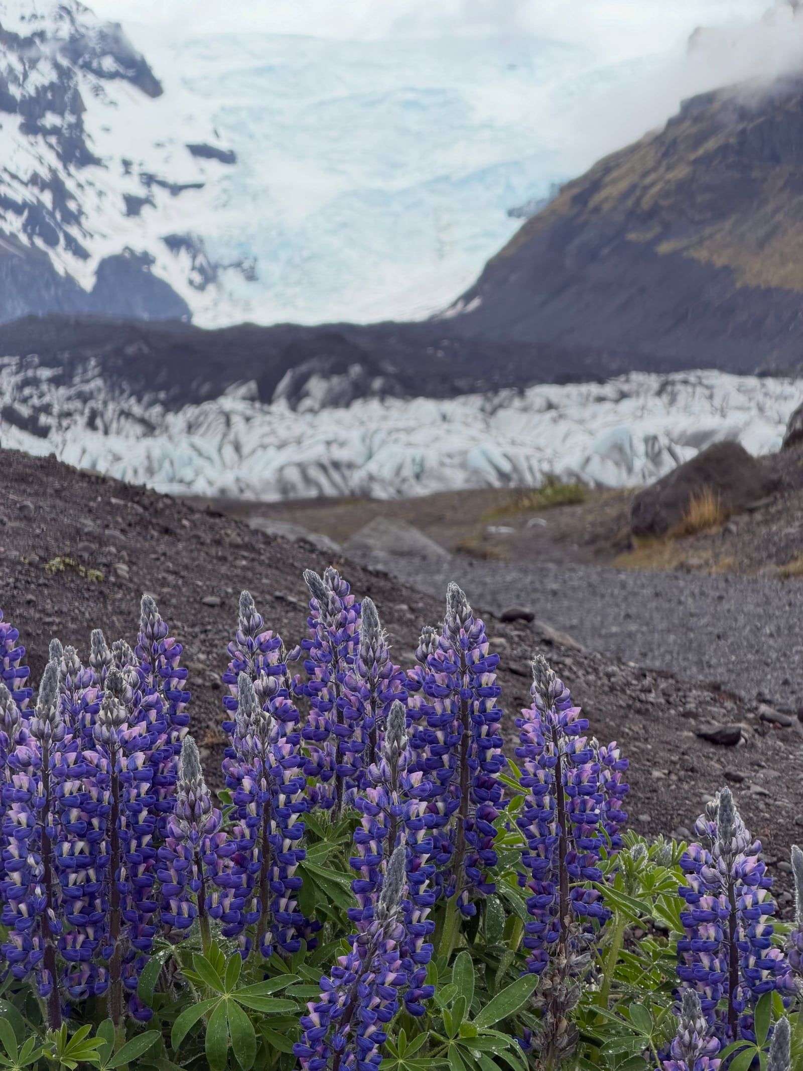
Sólheimajökull is an 8-kilometer-long river of ice descending from the Mýrdalsjökull ice cap. The glacier measures just over 2 kilometers across at its widest point. Its surface is a chaotic expanse of deep crevasses, sharp ice ridges, and vertical moulins. Meltwater carves these vertical shafts deep into the glacier, channeling surface water to the bedrock below. The ice depth varies, but the sheer walls provide ideal vertical surfaces for ice climbing tours. Climbers use ropes and dual ice axes to scale these blue faces.
The ice is not pristine white. Dark bands of volcanic ash streak the entire length of the glacier tongue. These black lines represent distinct historical eruptions from nearby Katla and Eyjafjallajökull. The contrast between the blue glacial ice and the black volcanic dirt defines the visual character of the site. The ash bands warp and fold as the glacier moves, creating intricate geometric patterns across the surface.
A proglacial lagoon sits at the glacier's snout. Icebergs calve off the leading edge and drift in the murky, sediment-heavy meltwater. This lagoon was virtually nonexistent a few decades ago. It grows larger every year as the ice margin recedes up the valley. The surrounding terrain consists of steep, moss-covered volcanic rock walls. These walls funnel the glacier toward the black-sand outwash plain of Sólheimasandur.
The approach trail is flat and gravel-covered, making it accessible for most visitors. Rockfall remains a persistent risk along the valley edges, especially during heavy rain or freeze-thaw cycles. There are no gates or fixed operating hours. The site remains open year-round. Visitors pay a 750 ISK parking fee via the Parka app. A basic paid toilet near the lot costs 300 ISK. Drone pilots frequently fly over the lagoon to photograph the icebergs. Icelandic law permits drones up to 120 meters in altitude, provided the pilot pays the 5,500 ISK registration fee and maintains a safe distance from crowds.
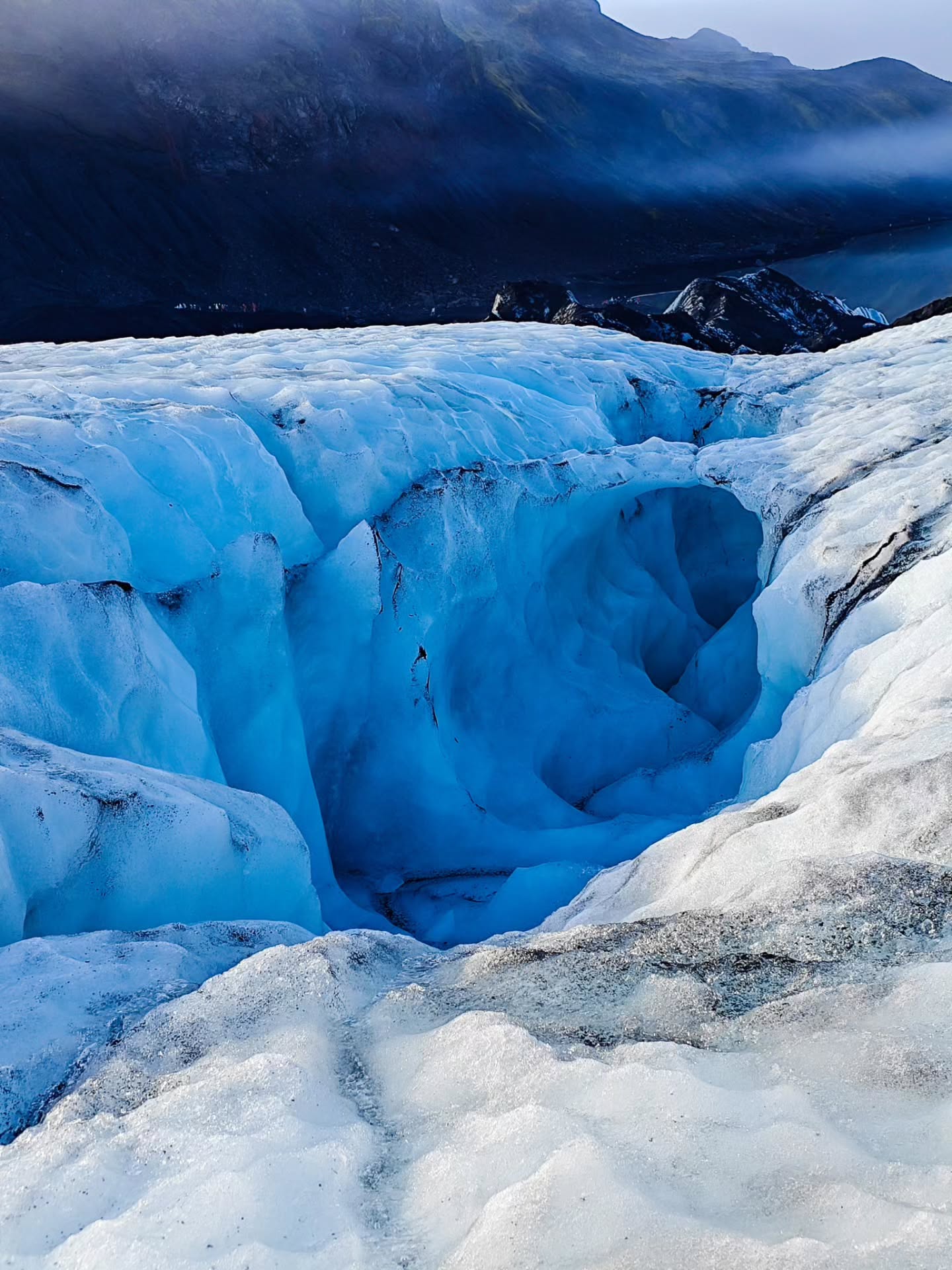
Sólheimajökull functions as Iceland's most visible climate laboratory. Its proximity to Route 1 brings thousands of visitors directly to the front lines of glacial retreat. Guides use the physical landscape to demonstrate environmental changes in real time. They point out bare rock walls where ice reached just five years prior. This accessibility turns a standard tourist stop into a stark, physical lesson on rising global temperatures. The glacier earns its nickname as a "climate glacier" because it responds so quickly to atmospheric changes.
The glacier anchors the local outdoor recreation economy. It is the primary training ground for Icelandic glacier guides and ice climbers. The predictable terrain allows outfitters to run daily excursions year-round. Operators like Guide to Iceland, Arctic Adventures, and Icelandic Mountain Guides run multiple daily departures. These tours typically cost between 11,000 and 35,000 ISK per person. This steady influx of hikers and kayakers supports businesses in nearby Vík í Mýrdal and Skógar. Tour buses arrive from Reykjavík daily, bringing visitors who spend money on local food, fuel, and lodging.
In Icelandic culture, glaciers are historically viewed as dangerous, impassable barriers. Sólheimajökull flips this dynamic. It is a place where people intentionally seek out the ice. The dark, ash-striped surface frequently appears in international photography and film. It cements the glacier's status as the quintessential representation of Iceland's "Land of Fire and Ice" moniker.
Local access norms allow free roaming to the glacier's edge, reflecting Iceland's broad right-to-roam laws. But authorities strongly discourage unguided travel onto the ice itself. The terrain is deceptive. A thin layer of snow can hide a 30-meter crevasse. Visitors must book a guided tour to step onto the glacier safely. Guides provide the mandatory helmets, crampons, and ice axes. They also monitor the daily hazard notices from the Icelandic Meteorological Office, ensuring groups avoid unstable ridges and rockfall zones.
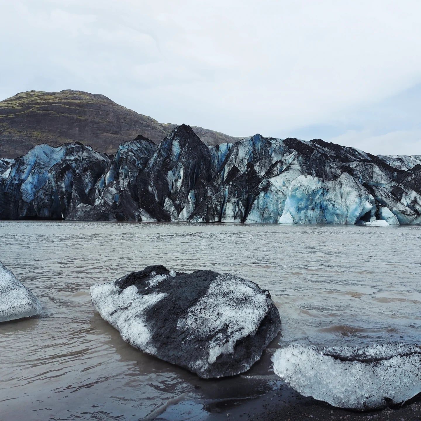
The black stripes in the ice are volcanic ash from past eruptions, including Eyjafjallajökull in 2010.
The glacier melts back approximately 60 meters every single year.
The lake at the base of the glacier is entirely new, formed by rapid melting over the last few decades.
Sólheimajökull flows directly over the Katla volcanic caldera.
The site has no operating hours and remains open 24/7 year-round.
In July 2026, severe melting caused an ice ridge to become unstable, forcing a temporary halt to guided hikes.
Meltwater from the glacier feeds a river that crosses the Sólheimasandur black sand plain to reach the ocean.
Yes, there is no entrance fee to view the glacier from the parking lot or viewpoint. The only mandatory cost is a 750 ISK parking fee for vehicles, paid through the Parka app. There is also a basic paid toilet near the lot that costs 300 ISK.
You can walk to the viewpoint independently. Stepping onto the ice requires a certified guide and safety gear. Solo glacier travel is highly dangerous due to hidden crevasses.
It is 158 kilometers away. The drive takes about 2 hours and 15 minutes heading east on Route 1.
The flat gravel trail covers about 500 meters. It takes 10 to 20 minutes each way. The distance increases slightly every year as the ice melts back.
Most operators require children to be at least 8 years old. They also need a minimum shoe size of EU 34 to fit the specialized crampons.
The viewpoint is generally safe. The ice itself carries risks like rockfall and unstable ridges. Always check the Icelandic Meteorological Office for current hazard notices before planning a hike.
Yes. There is a basic paid toilet near the parking lot. It costs about 300 ISK per use.
There is no direct public transit to the glacier. Travelers without a car usually book a guided day tour from Reykjavík. You can also take a public bus to Vík and arrange a taxi for the final 32 kilometers.
The glacier loses about 60 meters of ice per year. Between 1995 and 2014, researchers measured a total retreat of 887 meters.
Wear warm, waterproof layers and closed-toe shoes for the viewpoint. If you book a glacier hike, you need sturdy hiking boots with ankle support to attach crampons. Many operators rent boots for about 1,500 ISK.
Browse verified tours with free cancellation and instant confirmation.
Find Tours